N/A
Wild Wave River - North Pedder River
318655
5416701
2253
Conservation Area
Proposed
6429 8716
N/A
20/10/2008
Ansons Bay
603419
5456254
417
National Park
PWS
Completed
0427 570 108
N/A
20/10/2008
Ansons Bay
604889
5455852
171 ha
National Park & Private
PWS
Completed
0427 570 108
N/A
20/10/2008
Trial Creek Track East
361273
536968
4000 ha
Crown Land
PWS, FT
Proposed
6429 8716
N/A
20/10/2008
Whaleback Ridge
352737
5382428
1520 ha
Regional Reserve
PWS, FT
Proposed
6429 8716
N/A
20/10/2008
Stieglitz/St Helens
607378
5423641
2 ha
Coastal Reserve
PWS
Proposed
0427 570 108
N/A
4/09/2008
595403
873 ha
National Park & Regional Reserve
PWS, FT
Completed
0427 570 108
N/A
22/05/2008
Coles Bay
607560
5335044
1.1 ha
National Park
PWS
Completed
0427 570 108
N/A
22/05/2008
Coles Bay
607468
5335261
.7 ha
National Park
Completed
0427 570 108
N/A
21/05/2008
Coles Bay
606659
5336062
9 ha
Conservation Area
PWS
Completed
0427 570 108
N/A
21/05/2008
Bicheno
607004
5360748
107 ha
National Park
PWS
Completed
0427 570 108
N/A
15/05/2008
Bicheno
604539
5365396
100 ha
Conservation Area
PWS
Completed
0427 570 108
N/A
14/05/2008
Epping Forest
524401
5374503
1 ha
Nature Reserve
PWS
Completed
0427 570 108
N/A
12/05/2008
Reatta Road
508260
5412200
33 ha
Nature Recreation Area
PWS, Council
Completed
0409 506 029
N/A
30/04/2008
Binalong Bay
609760
5431760
75 ha
Nature Recreation Area
PWS
Completed
0418 513 695
N/A
29/04/2008
Binalong Bay
607160
5429880
8 ha
Nature Recreation Area
PWS
Completed
0418 513 695
N/A
24/04/2008
Bruny Island
526569
5206702
1.8 ha
Game Reserve
PWS
Completed
0417 384 548
N/A
23/04/2008
Tasman Arch
577000
5233700
13 ha
National Park
PWS
Completed
6213 8100
N/A
23/04/2008
Mt Spaulding
558086
5220579
40 ha
National Park
PWS
Completed
6213 8100
N/A
23/04/2008
Mt Spaulding
559577
5222909
245 ha
National Park
PWS
Completed
6213 8100
N/A
22/04/2008
Rebecca Creek
306882
5437958
3.7 ha
Conservation Area
PWS
Completed
0428 598 406
N/A
22/04/2008
Arthur River East
304150
5452700
7 ha
Public Reserve
PWS
Completed
0428 598 406
N/A
22/04/2008
Port Sorell
463524
5440492
10 ha
Conservation Area
PWS
Completed
0427 570 108
N/A
22/04/2008
Tasman Arch
577000
5233700
56 ha
National Park
PWS
Completed
6241 8100
N/A
19/04/2008
Ansons Bay
605967
5457026
120 ha
National Park & Private
PWS, TFS
Completed
0427 570 108
N/A
19/04/2008
Tullah East
385438
5377194
35 ha
Hydro, Regional Reserve
PWS, TFS
Completed
0428 598 406
N/A
18/04/2008
St Helens Pt
611261
5427563
9 ha
Conservation Area
PWS
Completed
0427 570 108
N/A
17/04/2008
Henty Rd
364610
5350433
3300 ha
National Park
PWS, FT
Completed
0428 598 406
N/A
17/04/2008
Coal Mines
558412
5240783
20 ha
Historic Site
PWS
Completed
6214 8100
N/A
16/04/2008
Coal Mines
559000
5241000
35 ha
Historic Site
PWS
Completed
6241 8100
N/A
15/04/2008
Port Sorell
460098
5444155
Nature Reserve
PWS
Completed
0427 570 108
44557
15/04/2008
Freycinet NP
606557
5330626
10 ha
National Park
PWS
Completed
44555
14/04/2008
Coles Bay
605911
5336827
24 ha
Conservation Area
Completed
0427 570 108
47101
28/02/2008
Tomahawk
564742
PWS, TFS
Completed
0427 570 108
47102
27/02/2008
583887
5465222
10 ha
Crown Land
PWS, TFS
Completed
0427 570 108
44556
26/02/2008
Freycinet NP
607705
5334036
52 ha
PWS
Completed
0427 570 108
Parks planned burn information can be found at http://www.parks.tas.gov.au/index.aspx?base=26614
All complaints relating to smoke should be lodged with the Environment Protection Authority (EPA)
24/7 contact number phone 1800 005 171 (see above).
24/7 contact number phone 1800 005 171 (see above).
Parks Managing Smoke from Planned Burns document:
"Impacts on populated areas are avoided if possible, particularly in conditions that would lead to high levels of smoke impacting on communities for more than a few hours."
There is no safe level of fine particle pollution. Smoke of any duration or intensity is known to be harmful; and especially harmful to vunerable groups. This 'few hours' goes against the World Health Organisations findings that air pollution in its entirety causes cancer.
Parks and Wilfe smoke can be in addition to other agencies smoke.
The Co-ordinated Smoke Management Strategy (CSMS) allows for the maximum amount of smoke to be put into an airshed on a given day.
It does not allow for smoke from previous days burns in the calculations by any of it's voluntary participating members, or smoke from other outdoor burning.
Photo courtesy DPIWE, Tasmania - Parks
'Managing Smoke' document.
Someone somewhere is copping this!
'Managing Smoke' document.
Someone somewhere is copping this!


Parks and Wildlife Service
Department of Primary Industry, Environment, Parks, Heritage and the Arts
Department of Primary Industry, Environment, Parks, Heritage and the Arts
24th March 2015 - Click on the picture above to read the full story
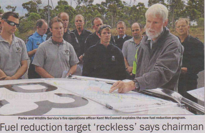
Go here to read more about the new State Fire Management Council Chairman
Go here to read more about the new State Fire Management Council Chairman
If smoke causes cardiac arrest in men why are we persisting with deliberate burning when there are other smokeless ways for fire mitigation?
Report recommends axing 5pc fuel reduction burning!
Click on the above photo to read the ABC News story for 22 May 2015
Click on the above photo to read the ABC News story for 22 May 2015
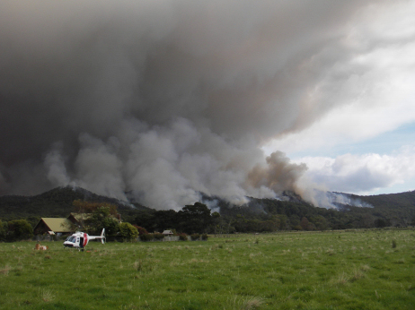
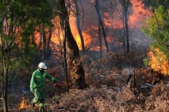
Here is an example of a Parks burn
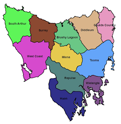
Tasmanian air sheds as defined by the Co-ordinated Smoke Management Strategy
Click on the graphic to enlarge
Click on the graphic to enlarge
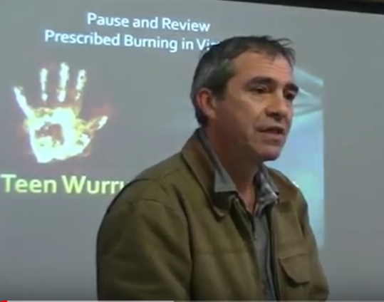
Joel Wright - "The Language of Fire."
Did Australian Aboriginals burn as we are told?
Fuel reduction and ecological burning etc. are based on the assumption that all Aboriginal people undertook fire-stick farming. Joel Wright, traditional owner in southwest Victoria, is an indigenous language, culture and history researcher. He finds no evidence of wide-scale burning in Aboriginal language and culture.
Click on the image above to watch the video.
Various proposals over the years have been floated, to exempt controlled burns from air quality rules. That does not make the air cleaner. It only makes it legal to smother towns and communities in smoke Californian resident and Retired firefighter David Sandbrook who studied fire science at Colorado Uni.
AFACs Predictive Services Systems Working Group sponsored a webinar on 19 December to demonstrate the Bureau of Meteorologys new Smoke and Air Quality Forecasting System (AQFx) modelling application for forecasting smoke and air quality in.... Tasmania.
We are currently using the AQFx system internally to predict smoke travel in Tasmania.
As this is still an experimental system, the results are not available to the general public. Some emergency management and land management agencies are able to see the smoke forecasts via a registered user page.
The system can predict smoke from planned burns prior to the burn taking place as well as smoke from existing planned burns or wild fires. The facility to predict smoke from planned burns depends on getting information on these burns from other agencies, and this may not currently be implemented in all jurisdictions.
https://www.youtube.com/watch?v=WKeHpw7s3No
Oregon: They like their fires, they like their smoke. They haven't heard of climate change?
Seems like they are so far behind in protecting their people's health
Seems like they are so far behind in protecting their people's health
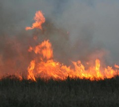
Local and regional smoke impacts from prescribed fires
Abstract : Smoke from wildfires poses a significant threat to affected communities. Prescribed burning is conducted to reduce the extent and potential damage of wildfires, but produces its own smoke threat. Planners of prescribed fires model the likely dispersion of smoke to help manage the impacts on local communities. Significant uncertainty remains about the actual smoke impact from prescribed fires, especially near the fire, and the accuracy of smoke dispersal models.
Abstract : Smoke from wildfires poses a significant threat to affected communities. Prescribed burning is conducted to reduce the extent and potential damage of wildfires, but produces its own smoke threat. Planners of prescribed fires model the likely dispersion of smoke to help manage the impacts on local communities. Significant uncertainty remains about the actual smoke impact from prescribed fires, especially near the fire, and the accuracy of smoke dispersal models.